
The American War of Independence was one of my first miniature wargames projects. I still haven’t finished. There’s always another unit to paint and another battle to create terrain for. At the library of Congress website, there is a section of maps and charts of North America and the West Indies 1750 – 1789 that miniature wargamers will find useful.
maps
Library of Congress Civil War Maps
Another treasure from the Library of Congress:
Civil War Maps brings together materials from three premier collections: the Library of Congress Geography and Map Division, the Virginia Historical Society, and the Library of Virginia. Among the reconnaissance, sketch, and theater-of-war maps are the detailed battle maps made by Major Jedediah Hotchkiss for Generals Lee and Jackson, General Sherman�s Southern military campaigns, and maps taken from diaries, scrapbooks, and manuscripts�all available for the first time in one place.
Most of the items presented here are documented in Civil War Maps: An Annotated List of Maps and Atlases in the Library of Congress, compiled by Richard W. Stephenson in 1989. New selections from 2,240 maps and 76 atlases held by the Library will be added monthly.
Confederate American Civil War Maps
The Library of Congress has a collection of
cartographic items made by Major Jedediah Hotchkiss (1828-1899), a topographic engineer in the Confederate Army. Hotchkiss made detailed battle maps primarily of the Shenandoah Valley, some of which were used by the Generals Robert E. Lee and Thomas J. “Stonewall” Jackson for their combat planning and strategy. Several of the maps have annotations of various military officers, demonstrating their importance in the military campaigns. The collection also includes maps made or used by Hotchkiss during his post-war years, including maps with information about railroads, minerals and mining, geology and history, most of which focus on Virginia and West Virginia, but also cover other states and even the world.
The collection consists of 341 sketchbooks, manuscripts, and annotated printed maps, the originals of which reside in the Library of Congress’ Geography and Map Division.
Texas Map Archives
If you’re into gaming the Mexican American war, or if you just have an interest in things Texas in general, you’ll find this map archives useful. There are a number of historical maps for you to view online:
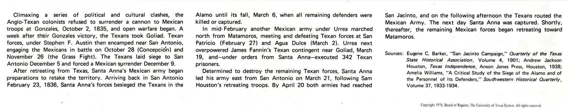
Texas Revolution, 1835-1836 – Text Description (120K) [p. 47]
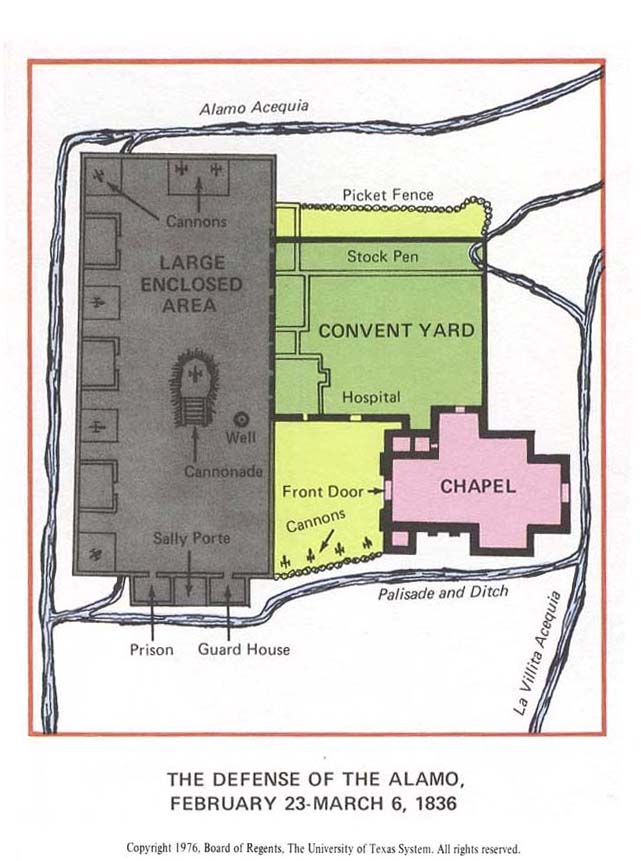
Texas Revolution, 1835-1836 – The Defense of the Alamo, February 23 – March 6, 1836 (75K) [p. 47]
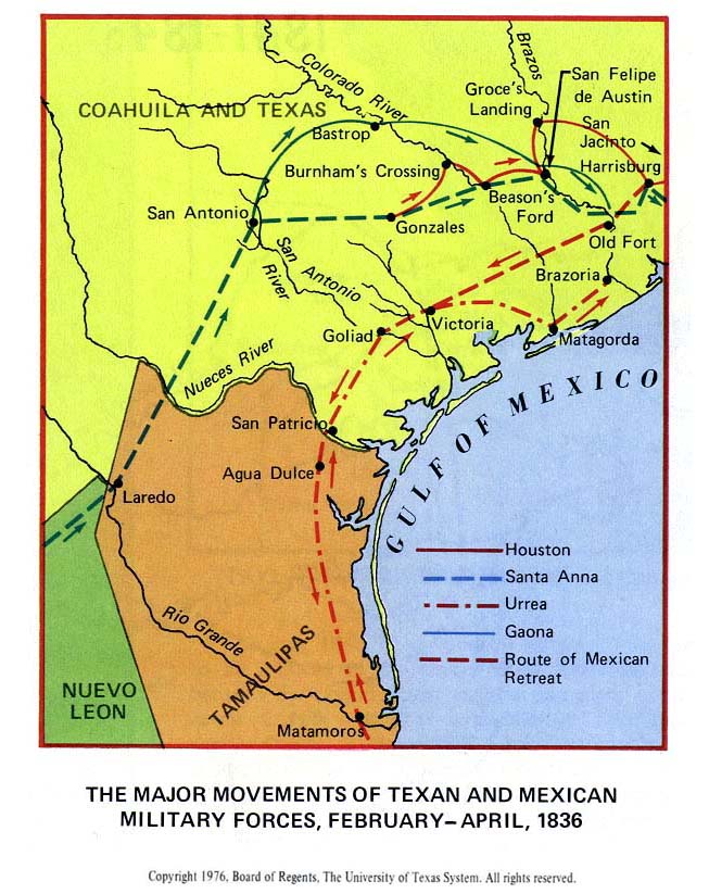
Texas Revolution, 1835-1836 – The Major Movements of Texan and Mexican Military Forces, February – April, 1836 (119K) [p. 47]
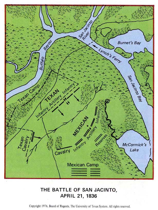
Texas Revolution, 1835-1836 – The Battle of San Jacinto, April 21, 1836 (145K) [p. 47]
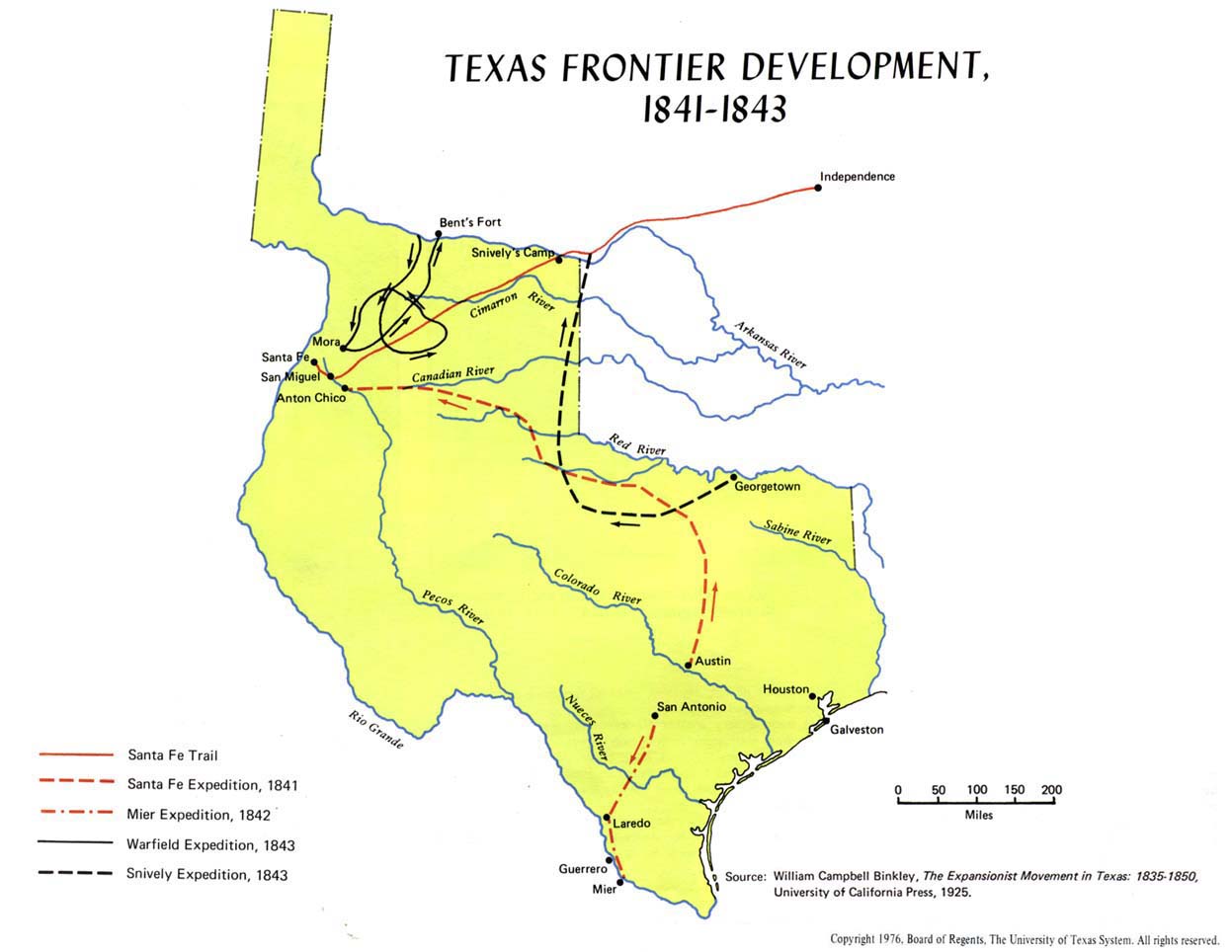
Texas Frontier Development, 1841-1843 (97K) [p. 48]
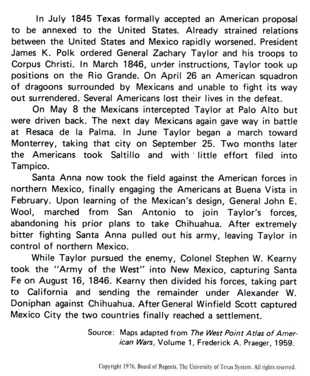
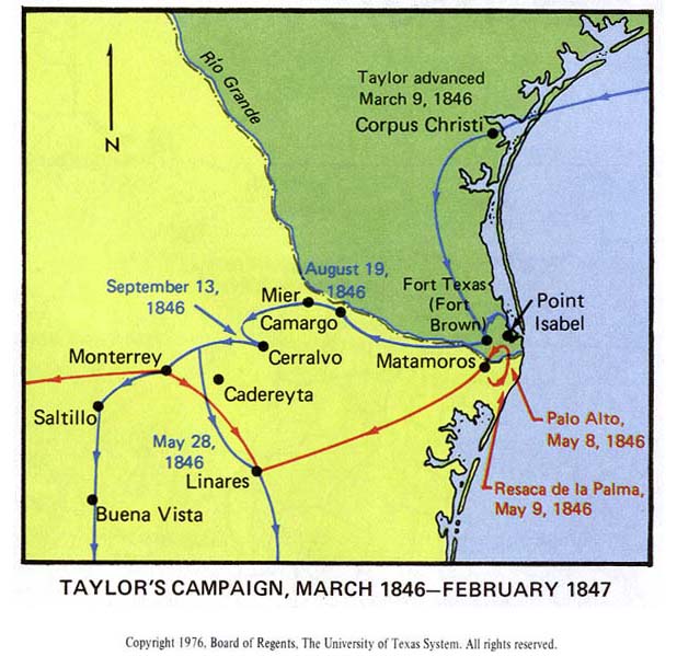
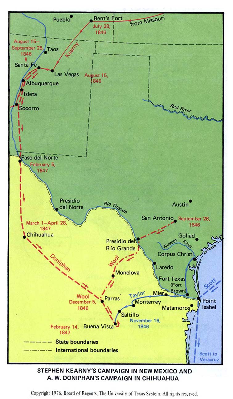
Mexican War Battles in Texas and Northern Mexico, 1846-1847 – Text Description (127K) [p. 49]
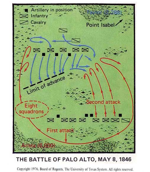
Mexican War Battles in Texas and Northern Mexico, 1846-1847 – The Battle of Palo Alto, May 8, 1846 (62K) [p. 49]
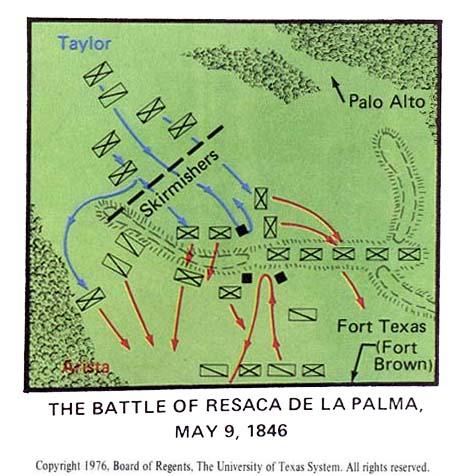
Mexican War Battles in Texas and Northern Mexico, 1846-1847 – The Battle of Resaca De La Palma, May 9, 1846 (50K) [p. 49]
Mexican War Battles in Texas and Northern Mexico, 1846-1847 – Taylor’s Campaign, March 1846 – February 1847 (69K) [p. 49]
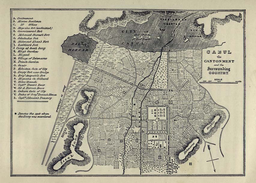
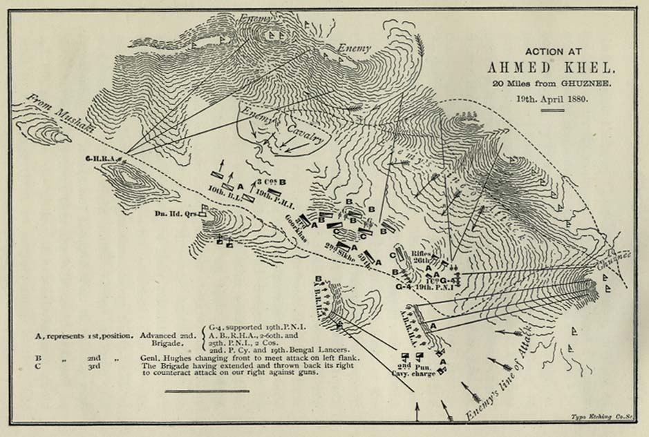
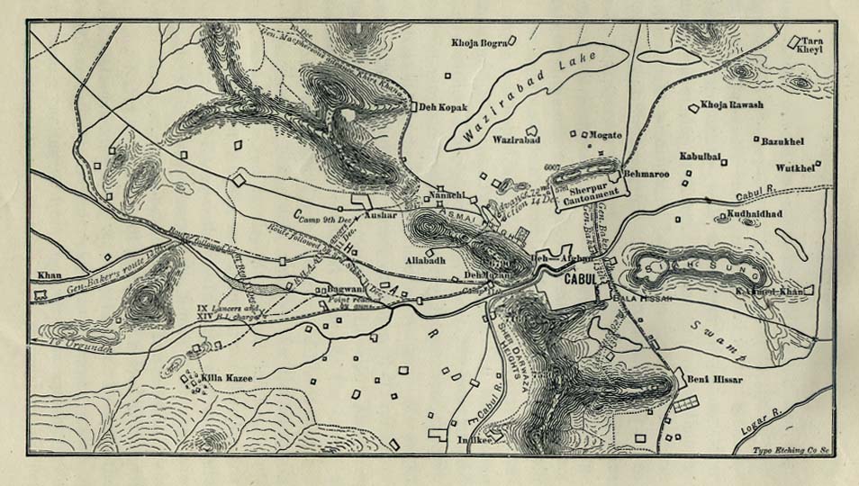
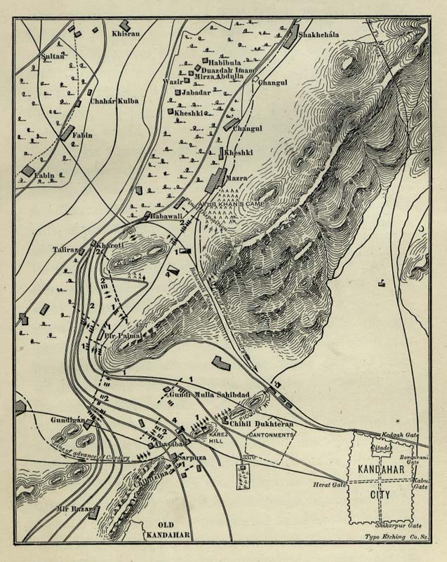
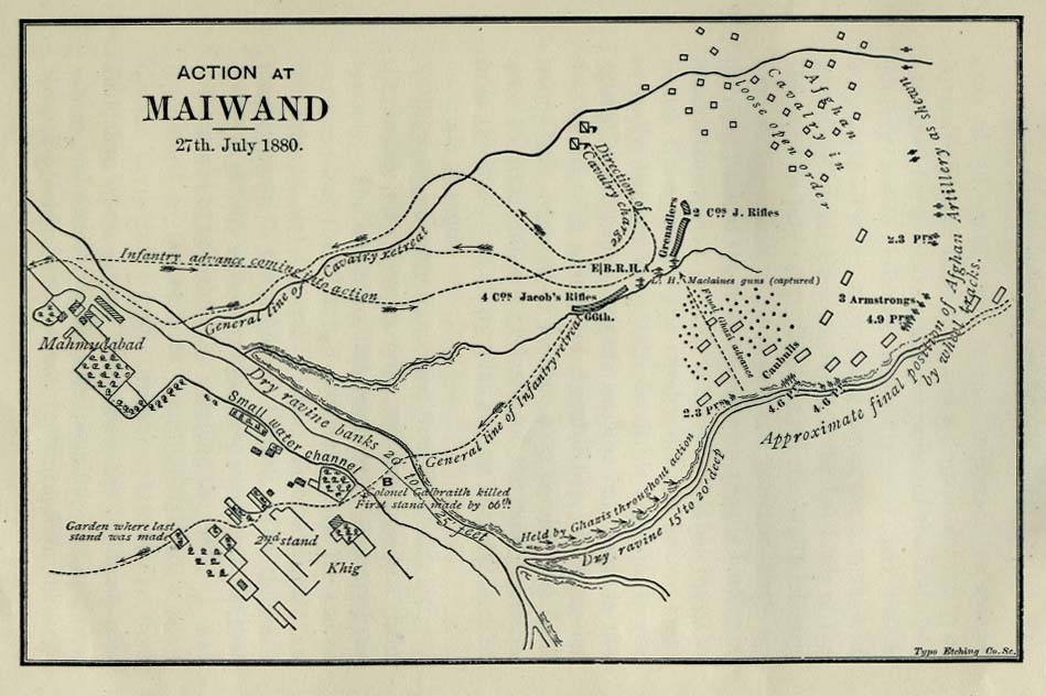
Maps From The First Afghan War
The University of Texas library has a nice set of historical maps from the First Afghan War: